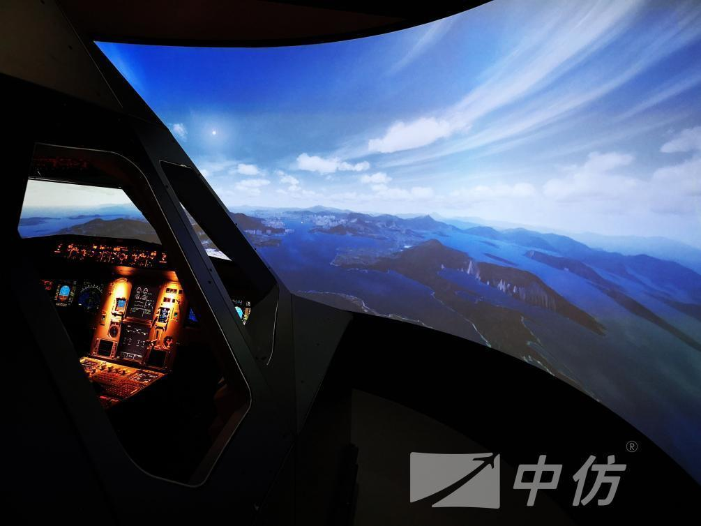
In order to make the flying personnel can feel the realistic flying environment, in the selection of high-quality hardware, at the same time, the use of high-precision visual software. Through the satellite photo level terrain database, the real mountains, roads, rivers and so on. For different airports where different customers are located, Chinese imitation can also achieve a more detailed degree than the outside of the airport in terms of ground texture through independent modeling, and restore airport terminals, lights, special vehicles and other facilities in the visual system. In different environments of day and night, the detailed light picture rendering can make the takeoff and landing training of flight personnel more immersive sensory experience, and fully achieve the training purpose.
In terms of weather, through the comprehensive calculation of temperature, air pressure and humidity, China Imitation has produced the conventional weather of rain and snow, the instrument weather of low clouds and low visibility, and the hazardous weather of thunderstorms and haze. In addition, the corresponding weather will be directly reflected in the flight performance of the aircraft, so that students can have a solid grasp of different measures to deal with different weather. For different customer groups, we provide different visual solutions to meet different training needs.
For more information about this product, please contact us:
cnfsimulator@gmail.com